Geographic Information Systems (GIS)
The Geographic Information Systems (GIS) division provides access to City GIS data through the use of interactive maps, static maps and property searches.
ArcGIS Online
The City's ArcGIS Online Portal allows users with an Arc GIS Online account to view, query, map, analyze and print using City GIS data.
Open Data GIS Portal
The City's Open Data GIS Portal allows users to download GIS data in various formats.
Property Information Search
This data search allows users to search for property in the city using addresses, parcel ids and other property data. The search result allows users to see the tabular data, to open a map for the property and to see the St. Lucie County Property Appraisers property card.
Interactive Mapping Applications
These interactive map viewers can be used to see a wide variety of information ranging from garbage pickup to planning projects. The GIS Interactive Map Viewers offer tools for viewing and querying spatial and attribute data.
General Applications

Main GIS Map Viewer
This app shows general information about the city including parcels, land use and zoning, shopping, schools and parks.

City Demographics
The demographics app shows various stats taken from the latest Census updates and American Community Survey data.

City Mapping Tool
The City Mapping Tool is an application used by city staff to create maps for different types of official documents like council agenda items. Users can draw on the map, select parcels and create a PDF printout to share.

Council District Finder
This application is designed to allow users to identify in which council district they live.

School Information
This application is designed to show the public and private schools in the city.

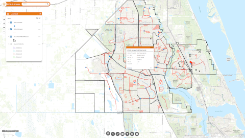
Capital Improvement Project Tracker
Residents have an easy way to stay informed about projects happening in the City of Port St. Lucie – everything from road improvements to new development.
BUILDING

Building Permit Locations
The permit location application is used to see the location and status of the building permits issued by the Panda System. Users can see the location, type, and status of permits.

Fence & Sheds
This application is used by builders and contractors to produce a diagram showing where a fence will be built and is required to obtain a permit.
NEIGHBORHOOD SERVICES

Community Residential Homes Mapper
Organizations that would like to start a Community Residential Home in the city will use this application to determine if their proposed location is in conflict with an existing facility.

Neighborhood Services Planning Area Projects
The Planning Area Project is an initiative by the Neighborhood Services Division to bring an identity to different regions in the city by creating neighborhoods.
PARKS & RECREATION

Parks & Recreation
The Parks and Recreation app shows the location of the parks and the amenities available.
PLANNING & ZONING

Planning & Zoning Projects
The project map viewer for the Planning and Zoning Department shows the status projects as they progress from approved to completed.
POLICE

Police District Zones
This application shows the Police Department district zones within the City of Port St. Lucie.
PUBLIC WORKS
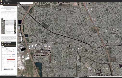
Driveway Diagram
The Driveway Diagram pdf required by the city to modify a driveway is produced using this application.
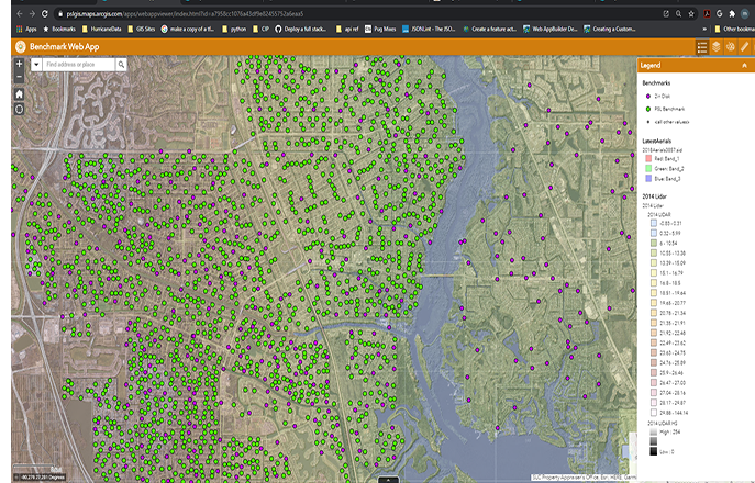
Elevation Benchmarks
The Public Works Elevation Benchmark Map lets surveyors and others see where the registered elevation benchmarks are within the city. It also shows the LIDAR elevation for the whole city.
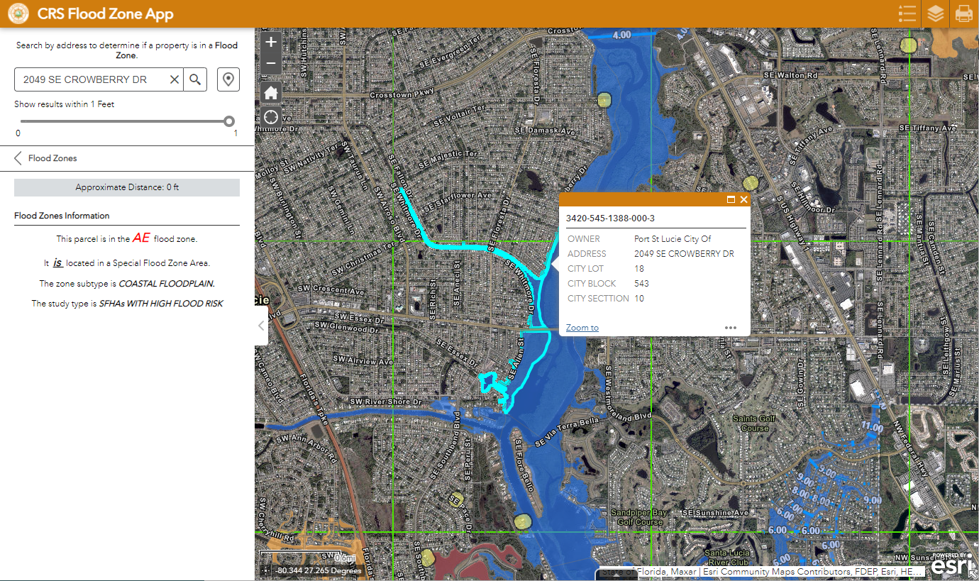
Flood Zones
This application is designed to assist both staff and citizens to determine the location of property in the city as related to flood zones determined by FIRM maps.
Keep Port St. Lucie Beautiful Distance Map
This application is designed to allow staff and residents to measure distances and create maps for adopting a street and cleaning rubbish.
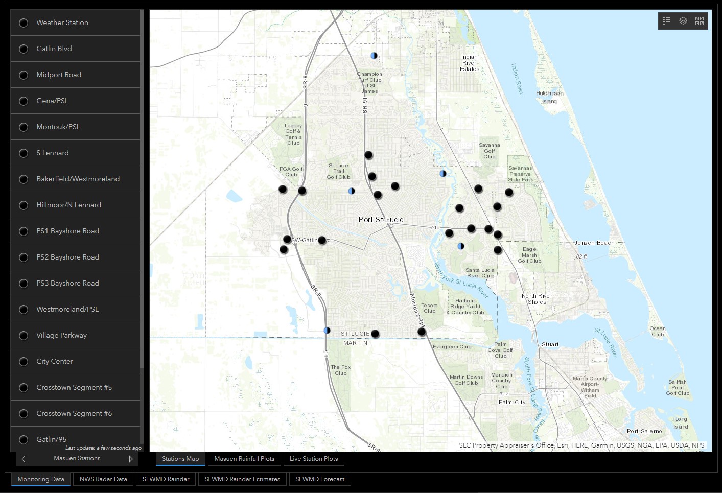
Rainfall Dashboard
This applications shows the amount of precipitation and other weather data from different weather stations in Port St. Lucie.
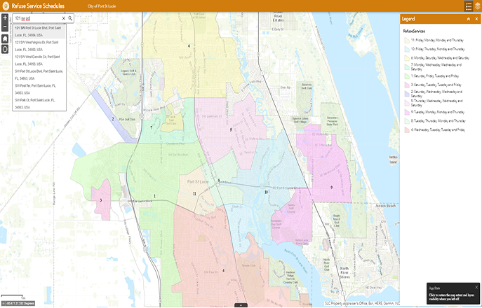
Refuse Collection Schedule
Citizens living in the city limits can use this app to see what when trash and recycling is collected.
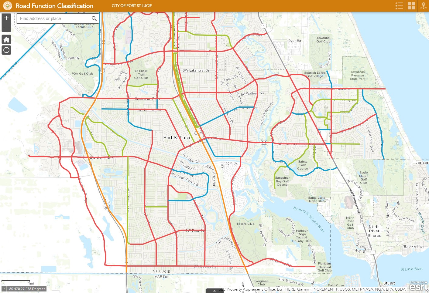
Road Function Classification
This Application shows the local roadway system by functional classification based on City’s own determination.
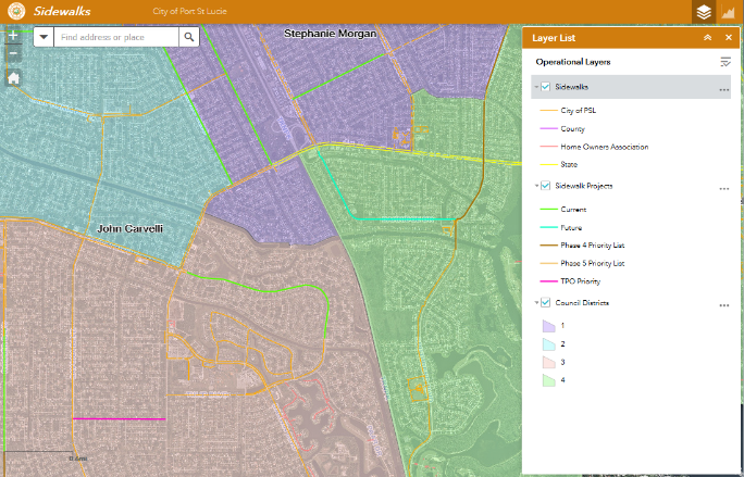
Sidewalks
The Sidewalk Application shows the current sidewalks and planned projects.
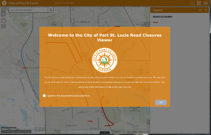
Street Closures
The Street Closures web map shows the locations of streets that are temporally closed, why they are closed and when they are expected to reopen.
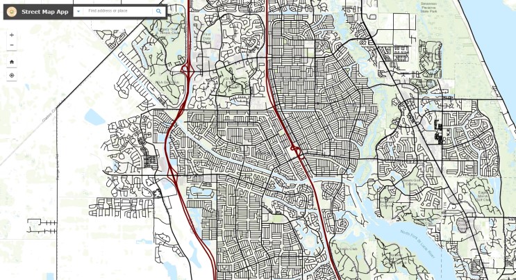
Street Map
The Streets Map shows streets and addresses in new developments that are not listed on Google Maps due to rapid growth.
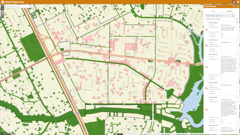
Vacant Lot
The Vacant Property Viewer is an app designed to assist both staff and citizens in dealing with overgrown vegetation on vacant lots.